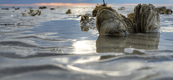
Chesterfield County | Charles City County | Powell Creek | James City County | Surry County | Isle of Wight County | Hampton Roads Area | Chesapeake Bay Sites
Chesterfield County
Appomattox River
- Follow Rt. 360 Wet 22 miles
- After crossing the river, pull into the median strip
- The canoe put in is between the two bridges.
- The CBF staff will meet you there.
Lake Chesdin
- Take I-95 south to the Temple Ave. exit in Colonial Heights
- Follow Temple Ave. West to Rt. 1 south
- Follow Rt. 1 south for 1.5 miles to Dupuy Ave
- Take a right onto Dupuy Ave.
- Dupuy Ave will turn into River road at the railroad tracks
- Take a left onto Rt. 600
- After the Chesdin Animal Hospital sign, take a right onto Rt. 601
- Continue on this road for 3.1 miles; take a right onto Rt. 776
- CBF staff will meet you at the boat ramp at the end of the road.
White Bank Park
- Follow Rt. 95 to Colonial Heights/Temple Ave. Exit
- Follow signs to the park.
- Take a left onto Conduit Rd. at the intersection of Temple and Conduit
- Follow road for about 2 miles, through 1 light and past a high school
- Turn left into White Bank Park, this turn is immediately across from Tussing Elementary School
- Buses can park at the top of the hill overlooking Swift Creek
Pocahontas State Park
- Take I-95 south to exit 61
- Go west on Route 10/Iron Bridge Road
- Turn right into park entrance, State Park Rd
- Make the first right after you pass the parking lot
- At the fork in the road, go right towards a pavilion and down the hill to the Swift Creek Landing
- CBF Staff will meet you there.
Charles City County
Herring Creek
- From Richmond, take I-64 East to exit #195/ Laburnum Ave.
- Turn right at exit stoplight onto Laburnum Ave.
- Continue on this road for about 6 miles and turn left at stop sign onto Rt. 5 East New Market Rd.
- Follow this road for approx. 17.2 miles, at this point; you will see a large brown sight for Harrison Lake Fish Hatchery.
- Stay on Rt. 5 approx. .7 miles after seeing the sign, you’ll cross a small bridge.
- Continue approx. .1 mile until you see the New Vine Baptist Church on the left.
- Turn Left into the church parking lot.
- CBF staff will meet you there.
Morris Creek
- Take 1/64 East to Providence Forge/ Rt. 155 South exit (exit 214).
- Drive on Rt. 155 for 5.7 miles (crossing Rt. 60 and the Chickahominy River).
- Turn Left on Rt. 614.
- In 3.7 miles, turn Left onto Rt. 615 at the stop sign.
- Continue on this road for about 6 miles. (At some point, Rt. 615 turns into Rt. 623 don’t let this confuse you!)
- Turn left onto Rt. 621.
- Travel 3.7 miles on Rt. 621 bearing right at the two forks you will encounter.
- About a mile from the second fork you will come to the boat landing where the CBF staff will meet you.
Powell Creek
- From Richmond, take Laburnum Ave. South
- Continue all the way down Laburnum until the stop sign at Rt. 5 (New Market Rd)
- Turn left, going east
- In 15 miles, (just after passing the Shirley Plantation), turn right onto Rt. 156 and cross the James over the Benjamin Harrison Bridge.
James City County
York River State Park in Williamsburg
- Travel towards Williamsburg, take the 231 B exit.
- Follow signs to York River State Park (turn right at Riverview Road and Left into the Park).
- CBF Staff will meet you outside of the Visitors Center.
Powhatan Creek in Williamsburg
- From Richmond, take I-64 E. to Williamsburg and exit onto Rt. 199S. towards Jamestown.
- Follow the signs to Colonial Jamestown.
- Turn right onto Ironbound Rd/Rt. 31.
- At the T-Intersection, turn right onto Rt. 31.
- The canoe launch will be just before Powhatan Creek on your right across from a plant nursery.
Surry County
Chippokes Plantation State Park
- Take 1-95 South to Rt. 10 east.
- Follow through town of Surry and turn Left onto Rt. 634 and follow signs to Chippokes Plantation State Park.
- The park will be on your left and we will beet you by the main visitor’s area straight ahead.
Isle of Wight County
Jones Creek
- From Richmond, take I-64 to Mercury Blvd. Exit.
- Follow Mercury Blvd south crossing the James River Bridge
- After the bridge, turn right onto Rt. 699.
- At a fork in the road, bear right onto Rt. 665.
- Follow 665 until you see signs for Public Boat Ramp on your left.
- If you get to Rescue, Va or cross the Pagan River, you have gone too far.
Hampton Roads Area
Bluebird Gap Farm
- Take bI-64 East to exit 263-B (Rt. 258/Mercury Blvd./Hampton Coliseum)
- Go East on Mercury Blvd.
- Make a right at the first light onto Coliseum Drive.
- Make another right onto Pine Chapel Rd.
- Bluebird Gap Farm is just over the overpass and on the left
- CBF staff will meet you at the entrance.
Long Creek
- Take I-64 E. to exit #263 (Rt. 258 E/Mercury Blvd/Hampton Coliseum
- Drive approx. 3 miles on Mercury Blvd.
- Turn Left at stoplight onto Rt. 169 N (Foxhill Rd).
- Drive Approx. 3 miles on Foxhill Rd. to a stoplight (Rt. 169 S goes to the right here)
- Continue just past the stoplight and make a left onto Beach Rd.
- Turn left onto Beach Rd. You will see signs at this intersection for “Public Boat Landing” and “Grandview”, both pointing to the left.
- Continue on Beach Rd. In 2 miles, you will see a brown Public Boat Landing sign at Dandy Point Rd. Do not turn here continue straight for approx. 1 mile until you reach a dirt pull off JUST before a small bridge over Long Creek.
- The CBF trailer will meet you here.
Bennett Creek
- Take I-64 East to Mercury Blvd. Exit (from Richmond)
- Follow south crossing the James River Bridge
- Follow Rt. 17 East to the left and across the Nansemond River
- Cross Bennett Creek
- Continue for ? mile and turn right onto Rt. 626 (Shoulders Hill Rd)
- Travel about 1 mile and turn right into Bennett Creek Park with Public Boat Launch sign.
- CBF trailer will meet you there.
Chesapeake Bay Sites
Long Creek in Hampton
- Take I-64 to exit # 263 B (Rt. 258 E/Mercury Blvd./Hampton Coliseum). Drive approx. 3 miles on Mercury Blvd. Turn Left at the stoplight onto Rt. 169 N. (Foxhill Rd.) There is a brown sign that reads “Public Boat Landing” at this intersection.
- Drive approx. 3 miles on Foxhill Rd. to a stoplight. (Rt. 169 S. goes to the right here).
- Continue just past the stoplight and make a Left turn onto Beach Rd.
- Turn Left onto Beach Road. You will see signs at this intersection for “Public Boat Landing” and “Grandview”, both pointing to the left.
- Continue on Beach Rd. In 2 miles, you will see a brown sign for a public boat landing at Dandy Point Rd. Do not turn here, but continue straight for approx. 1 mile/you are still on Beach Rd.
- Watch for a dirt pull off on the right JUST before a small bridge over Long Creek.
- The CBF staff will meet you there.
Seashore State Park in Virginia Beach
- From Richmond, take I-64 towards Petersburg/Norfolk.
- Take the I-264 West/Va 44 East exit
- Exit on the Left towards Va. Beach on 44 East.
- 44 will go all the way into the city of Virginia Beach.
- Turn Left onto Pacific Ave.
- Pacific Ave. becomes Atlantic Ave.
- You will notice that the streets are numbered and they count up as you go north.
- Turn Left onto 64th Street.
- At the end of 64th street, go through the entrance for Seashore State Park.
- Follow the main drive until you arrive at a small circular driveway in a wooded area.
- CBF staff will meet you there.