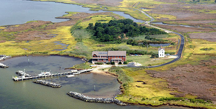
1304 Phillips Gunning Club Rd.
Crocheron, MD 21627
410-397-8014 (center)
443-205-2321 (cell)
Map
Important Notes:
*PLEASE FOLLOW DIRECTIONS LISTED BELOW* GPS platforms will provide the shortest/quickest route to KNC, where many roads are frequently underwater! Do NOT take Maple Dam Rd off Route 16 or Percy May Rd off US-13.
During certain tides, winds, and storms the road to the center may be completely covered with water. In those instances, it may be necessary for us to meet your group at the public boat landing in Crocheron to get to KNC via boat. It is imperative that you call/text the Karen Noonan Center staff 443-205-2321 once you get to Cambridge, MD to determine if you will be able to drive all the way in.
From the Bay Bridge (MD)
- Take US-50 East to Cambridge
- In Cambridge, follow Us-50 East to the intersection with Route 16.
- Turn right onto Route 16 (right after Wal-mart)
- Follow Route 16 for about 8 miles to the town of Church Creek
- *Turn left onto Route 335
- Follow Route 335 for about 10 miles until it meets with Route 336 at Gootee’s Marine in the town of Golden Hill.
- Turn left onto Route 336.
- Follow Route 336 as it winds through the towns of Crapo, Wingate, and Bishop’s Head (there aren’t official signs to signify which town you are in)
- Follow 336 around the sharp left turn at Tom Jones Market (market on right side of road)
- Continue on 336 to Crocheron
- Continue straight (off 336) onto Phillips Gunning Club Road (Pavement turns to gravel)
- Continue about 1 mile until road dead ends at the Karen Noonan Center. (KNC painted mailbox will be left at the driveway entrance)
From the Bay Bridge-Tunnel (VA)
- Follow US-13 N towards Maryland
- Continue on to US-50 West to Cambridge, MD
- Do NOT take Percy May Road it will lead you to Maple Dam Rd which floods often
- Turn left where US-50 meets Route 16 (before Walmart, after Hebron Bank)
- Take the 2nd exit via roundabout and follow Route 16 for about 8 miles to the town of Church Creek
- Follow from * above.
Crocheron Public Boat Landing
In the event of road flooding, you may be asked to take your group to the Crocheron Public Boat Landing where we will take a boat the rest of the way to KNC.
- Follow directions above. Instead of getting off of Route 336 and going onto Phillips Gunning Club Road, stay on Route 336 by making a sharp left at the entrance of Phillips Gunning Club Road. Follow the road until it ends at the Crocheron Public Boat Landing.


