This is the fourth blog in a series about the great clean water work that is happening upriver in West Virginia, Delaware, and other states that don’t directly border the Bay. Much of the funding and resources for this critical work are only made possible through the landmark 40-year Bay partnership, a collaborative effort between states, the federal government, and local partners to reduce pollution and restore habitats across our remarkable watershed.
Growing up near Laurel, Delaware, Jamie Smith rarely thought about the Chesapeake Bay. In fact, she had no idea that Broad Creek, the waterway that runs through the small town, was a Bay tributary.
“I thought ok, it’s the Broad Creek. It goes into the Nanticoke River and beyond that I didn’t know. I didn’t think about ‘where’s the Nanticoke River going?’” she said.
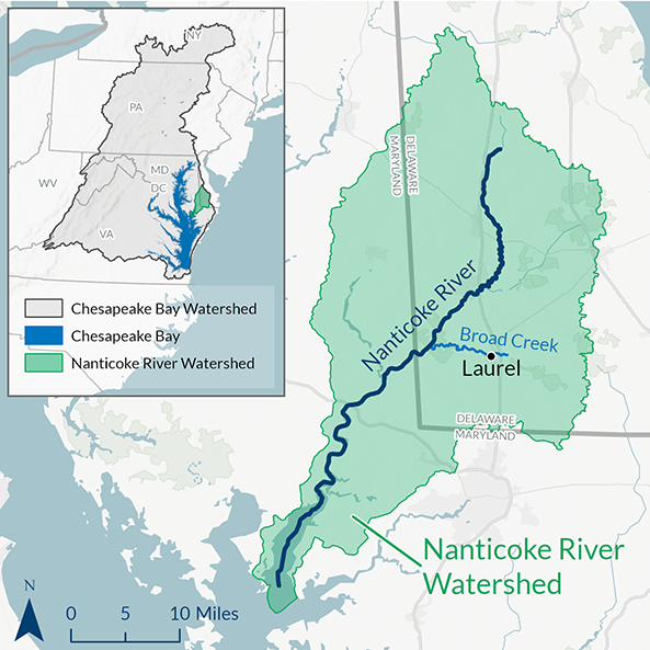
Map of Broad Creek and the Nanticoke River.
Chesapeake Bay Foundation
Nor do most Laurel residents, she figures. But as town manager, Smith knows that Laurel’s connection to the Bay is more than geographic. It’s the foundation—and a key funding source—for the town’s ambitious waterfront redevelopment plan called The Ramble.
The sweeping initiative aims to revitalize Laurel by attracting residents, visitors, and local businesses to Broad Creek’s banks. But that wasn’t the original goal. It started as, and remains, a plan that uses green infrastructure to reduce polluted runoff into Broad Creek, the Nanticoke River, and ultimately the Chesapeake Bay.
One reason the struggling town can afford to pursue its lofty vision is its connection to the Bay. The Ramble provides a blueprint for how Laurel can grow and still protect water quality in a Bay tributary. That makes projects to realize this vision eligible for funding from the EPA Chesapeake Bay Program.
Ed Lewandowski, who spearheaded the development of the Ramble, said Laurel has secured “millions” to build it out since adopting the plan in 2013. That includes a “significant contribution” from federal and state funds tied to Bay restoration.
Why Is Green Infrastructure Important?
Founded in 1686, Laurel was a prosperous mill town in the 1800s. Its waterside location also made it a commercial hub before railroads came along. But like many American small towns, Laurel has been hit hard by shifting economic and demographic trends since the late 20th century.
Today Laurel is Delaware’s poorest town, according to data compiled from the U.S. Census Bureau’s 2022 Economic Census. Roughly 45 percent of the town’s 4,400 residents are renters, not homeowners, Smith said. Ten years ago, the rental rate was even higher, hovering around 50 percent, Smith said.
Home ownership is on the rise in large part because of the Laurel Redevelopment Corporation (LRC). Business leaders created the LRC in 1992 to revive Laurel’s decaying downtown, build homes, and boost civic pride. By the time Lewandowski came to town in 2012, the LRC had already replaced numerous blighted buildings with parks, residences, office space, and an upscale restaurant with patio seating on Broad Creek, said Executive Director Brian Shannon.
Lewandowski and Shannon joined forces as The Ramble concept was taking shape. Lewandowski is the University of Delaware Sea Grant program’s community development specialist and coordinator of the university’s Sustainable Coastal Communities Initiative.
The Ramble is finally coming to life. There’s a nature-based playground that celebrates Nanticoke Indian culture, a popular kayak launch, and a constructed wetland that is bringing new life and flood control to an area once known as “the mud hole.”
“We’ve been working now for the past ten years to put that plan in place, and now it’s happening,” Lewandowski said. “I’m really happy to see this here—energy, people thinking about possibilities. That for years was missing Laurel from what I saw.”
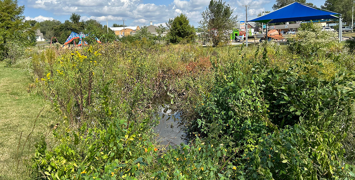
Constructed wetlands adjacent to Tidewater Park, which can be seen in the background, absorb water from heavy rains and protect the area from twice daily high tides from Broad Creek. The new wetlands have also created a rich ecology for wildlife.
Lisa Caruso/CBF Staff
Celebrating Nanticoke Culture at Laurel’s Tidewater Park
The centerpiece of The Ramble is Tidewater Park. The recently completed playground honors the region’s first inhabitants, the Nanticoke Indians. Nanticoke, translated from “Nantaquak,” means “people of the tidewaters” in Algonquin.
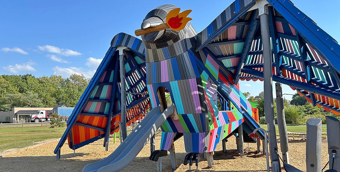
It features brightly colored playground equipment in the shape of a beaver gnawing on a log, a squirrel with a built-in chair for a storyteller, an oversized turtle in a sandbox, and an 18-foot-tall rainbow-colored crow with a 30-foot wingspan and a lit torch in its beak. Members of the local tribe were actively involved in creating the playground, Lewandowski said.
Each play piece tells a story from Nanticoke Indian lore: How the Beaver Got its Tail, Squirrel Council, the Turtle Island creation story, and Rainbow Crow. The park also boasts a children’s zip line, swing sets, a covered pavilion, and walking paths. Picnic tables are on the way.
“There’s a lot of buzz in the community about Tidewater Park.,” Lewandowski said. “It really is an anchor element to the downtown area. When you come down Central Ave [the main road into town], boom, it’s there, it’s in your face. It’s bright. It’s colorful. It’s active.”
And people love it, Smith said.
“There is not anything like it around here,” she noted. “There’s not one in Seaford. There’s not one in Georgetown. There’s not one over to the beach. It’s here in Laurel. It makes us as a town feel good that we have something that other people don’t have. I can guarantee you right now there’s no other rainbow crows sitting around [the region]” she says.
An adjacent one-acre constructed wetland absorbs water from heavy rains that used to flood the area, a 100-year floodplain. It also allows water from Broad Creek to enter during the high tides that occur twice a day. A 300-foot long, winding grassy channel called a “bioswale” collects and diverts stormwater from upland paved surfaces and filters out pollutants and sediment before the water reaches Broad Creek.
Lewandowski said the native plants, trees, and grasses also attract a diverse array of wildlife.
“You can see aquatic life—small fish fry and juvenile fish. You can see frogs. You can see birds that are preying on these animals. So, there’s a nice little dynamic going on there, [with the] ecology of the wetland and how it interacts with Broad Creek,” Lewandowski said.

Washington, D.C. Communications & Media Relations Manager, CBF
[email protected]
202-793-4485

